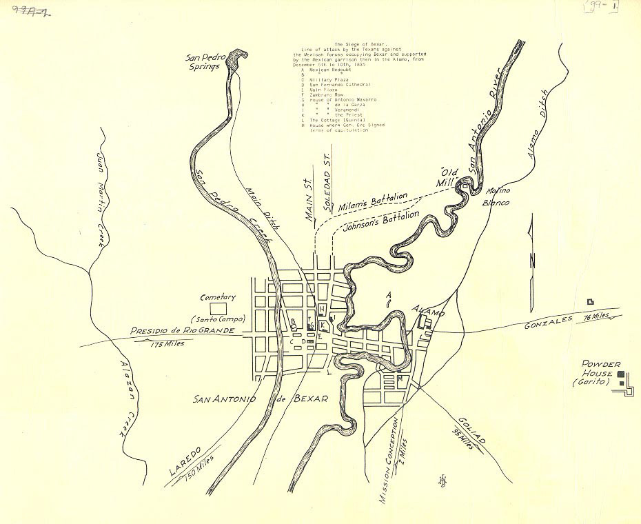
| Picture Description: |
Shows the layout of San Antonio de Bexar, including
roads, major buildings, rivers, and creeks. The distance to various
locations is given. Note on map "Line of attack by the Texans
against the Mexican forces occupying Bexar and supported by the
Mexican garrison then in the Alamo, from December 5th to 10th,
1835." Superimposed are some twentieth century streets of San
Antonio. This map accompanies the book Texas Independence, by
Andrew Jackson Houston, 1938; Texas State Archives Map Number
0099-1 |