Leeds originated as an Anglo-Saxon township on the north bank of the Aire. It grew as a local market centre and was incorporated in 1626. By then the town was a cloth-finishing centre for a wide area where domestic weaving, introduced by 14th-century Flemish weavers, was pursued. By the 16th century Leeds was able to challenge the supremacy of York and Beverley in the woolen-manufacturing trade. With the Industrial Revolution and development of the local coalfield, the woolen industry was surpassed in importance by engineering, and for a time pottery and linen manufacture were also important. The completion in 1816 of the Leeds and Liverpool Canal also stimulated Leeds's growth, and after 1848 the railway made the city a major centre of locomotive engineering. The end of that century saw a great expansion of the factory production of ready-made clothing, drawing labour from an influx of Jewish immigrants into the city.
In the modern city, factories are largely concentrated in the southern and eastern areas, where engineering and electronics, printing and publishing, food processing, chemicals, and furniture are especially noteworthy among a great diversity of industries. Leeds is also an important regional centre for insurance and financial services and is the major shopping and commercial centre for West Yorkshire.
There are few historic buildings in the city proper, and new housing estates in both the suburbs and the city centre have replaced former slum areas. Retail shopping markets, grain and stock exchanges, and some fine Victorian arcades occupy the old town site. Nearby is the Town Hall (1858), an impressive Victorian building that contains the law courts and a large concert hall; triennial musical festivals are held in the Town Hall. The city's more modern civic buildings include the Civic Hall (1933). There is also a civic theatre. Leeds has two universities, many specialized colleges, and a boys' grammar school that was founded in 1552. Other amenities include a nationally famous cricket ground at Headingley, a football (soccer) ground at Elland Road, a championship golf course at Moortown, and more than 200 parks and open spaces, chief among which is Roundhay Park.
Besides the historic town and urban area of Leeds, the city and metropolitan borough include the towns of Morley, Pudsey, Horsforth, Garforth, Kippax, and Rothwell and an area of open countryside, woodlands, and rural villages. The M1 motorway from London to Leeds crosses the M62 motorway connecting Liverpool and Manchester with Kingston upon Hull. Northwest of Leeds is an airport at Yeadon. Area metropolitan borough, 213 square miles (552 square km). Pop. (1991) Leeds urban area, 424,194; (1998 est.) metropolitan borough, 727,400.
Links:
GENUKI, Colin Hinson's UK and Ireland Genealogy website
The Ancient Parish of Leeds
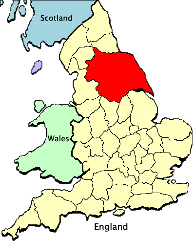
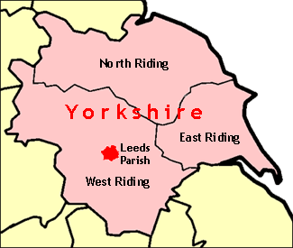
Yorkshire
About the Fairfield Family 
Woodsum